[wpgmza id=”2″]
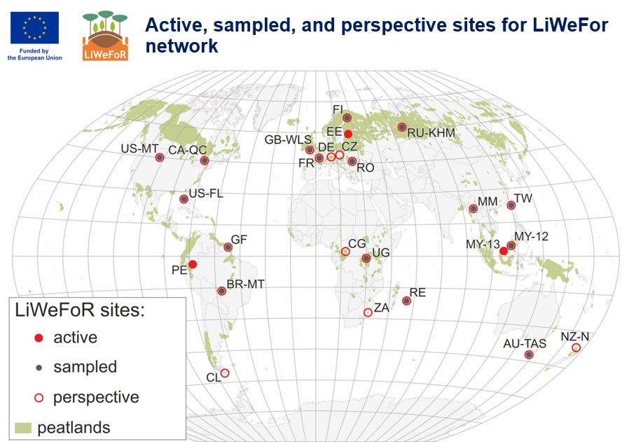
Active (functioning sites of LiWeFoR)
| State ISO code | Name | Location | Ecosystem type | Contact person | Literature |
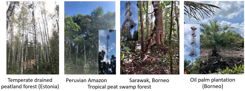
| EE | Agali* | 58.292, 27.317 | Drained birch forest | Ü. Mander | Truu et al. 2020, Viru et al. 2020, Espenberg et al, Kazmi et al. 2025 |
| MY-13 | Maludam* | 1.454, 111.149 | Hardwood swamp forest | L. Melling | Melling et al. 2024 |
| MY-13 | Betong* | 1.400, 111.399 | Oil palm plantation | L. Melling | Melling et al. 2024 |
| PE | Quistococha* | -3.850, -73.319 | Palm swamp | L. Fachin | Griffs et al. 2018, Soosaar et al. 2022, Parn et al. 2023 |
| PE | Zungarococha | -3.838, -73.362 | Secondary swamp forest | L. Fachin | Parn et al. 2023 |